Call: 1-800-832-7191
Maritime Navigation: Then & Now
October 6, 2025
Maritime Navigation: Then & Now – A Journey Through Time
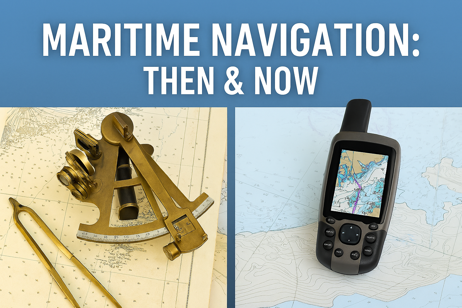
Maritime Navigation: Then & Now reveals how seafaring has evolved from ancient instincts to satellite-guided precision. Mariners once relied on stars, wind, and instinct. Today, they use GPS, sonar, and digital charts. This transformation has reshaped global trade, safety, and exploration.
Ancient Techniques That Shaped the Seas
Long before modern tools, sailors used the sun, moon, and stars to guide their journeys. Polynesians read wave patterns and bird flight. Vikings relied on sunstones and coastal landmarks. These methods, though primitive, were surprisingly effective for their time.
However, navigation remained risky. Storms, fog, and human error often led to shipwrecks. Despite these dangers, ancient mariners expanded trade routes and cultural exchange. Their courage laid the foundation for future innovation.
Maritime Navigation: Then & Now – The Age of Instruments
As centuries passed, tools like the astrolabe and sextant revolutionized navigation. These instruments allowed sailors to calculate latitude with greater accuracy. Compasses improved directional awareness, while chronometers enabled longitude tracking. Together, these tools reduced guesswork and increased safety.
During the Age of Exploration, these advancements fueled global discovery. European powers mapped coastlines, established colonies, and expanded maritime empires. Navigation became a science, not just an art. Still, even with better tools, weather and war posed constant threats.
The Digital Revolution at Sea
In the 20th century, maritime navigation entered a digital era. Radar, sonar, and radio communication transformed how ships operated. GPS became the gold standard, offering real-time positioning with pinpoint accuracy. Mariners could now avoid hazards, track weather, and communicate instantly.
Moreover, electronic chart systems replaced paper maps. These systems update automatically and integrate with autopilot features. As a result, voyages became faster, safer, and more efficient. Maritime Navigation: Then & Now shows how technology continues to reshape the industry.
Despite these advances, traditional skills remain valuable. Many captains still learn celestial navigation as a backup. Redundancy ensures safety in case of system failure. Thus, modern mariners blend old and new techniques for optimal results.
Looking Ahead: Innovation and Sustainability
Today’s maritime navigation focuses on sustainability and automation. Autonomous vessels are being tested for cargo transport and research missions. These ships use AI, sensors, and satellite data to navigate without human input. Although still emerging, this technology could reduce costs and emissions.
Additionally, environmental monitoring tools help ships avoid ecologically sensitive areas. Real-time data supports decisions that protect marine life and habitats. Navigation is no longer just about reaching a destination—it’s about doing so responsibly.
Organizations like NOAA’s Office of Coast Survey provide updated charts and navigation tools. These resources support safe and sustainable maritime operations worldwide. As technology evolves, so does our responsibility to the oceans.
Visit the United States Coastguard’s Office of Navigation Systems. Like this blog…visit our Boaters Blog for more!